Organised birdwatching in Miri probably started already way back when during the early days of MNS Miri Branch with Meh Jabeen, Gek Lan, Charlie, Selva, Hans, Mario, Rhett and other founding members of the branch most of whom are either researchers from Kyoto University based in Lambir Hills National Park or employees of Shell; either those posted from overseas or West Malaysia to Sarawak who happened to be birdwatchers previously.
Slowly avid birders consolidated to include local born and bred Mirians, Sarawak Forestry staffers and consultants. John Parr, Zaidi, Kamal, Bor Seng and Mr Tan were the few who started the Asian Wetland Census in Miri which in time became an annual affair for the Branch.
The person who opened most of our eyes to birdwatching in Miri has got to be John Parr, then a consultant with Sarawak Forestry. One other person I think who instrumentally introduced us to waders has got to be a localised retired Shell expat (married to a local) who alerted us to those "big eyed" brown little birds out at the old Miri River. Over the years Dave Bakewell were in Miri to conduct classes for Branch members as well as SFC staffers.
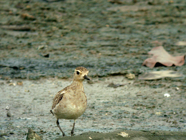
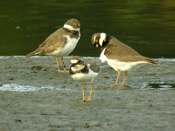
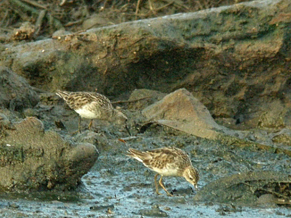
The photos posted here were taken in Feb-Mar 2008. At the time Sg Miri was already under refurbishment by the Jabatan Pengairan with input from several local environmental consultants based in Kuching. Today this site is now where the apartments, shop blocks and Pullman Miri are standing.
These images are just for record of the birds that used to make their pitstop in Miri on their way south during the Autumn migration, or north during their Spring Migration. On one or more occasions, Mr Tan and Bor Seng were with me when these images were made.


"The Miri River used to meander along the mangrove lined banks of Kampung Pulau Melayu and eventually end up on an estuary right in front on the ex-Hilton Hotel location (now Park Everly Hotel) before flowing into the South China Sea.
There used to be an extensive area of mudflats during low tide from the old Miri ferry point to the sea. Sometime around 1999 the Resort City project started off with massive land reclamation efforts along the South China Sea onwards from the Miri Golf course all the way to the Miri estuary and beyond.
Today the whole section is now known as the Miri Marina, old mangrooves has been replaced with ornamental causarinas. Forward planning for the newly developed area included an esplanade winding along the beach side of the reclaimed area as well as a new exclusive seaside bungalow lots around the Marina towards the city center.
The old Miri River mudflats is now no more ..."
Would be great if someone could make a similar panoramic picture of the area as it stands now ... perhaps it's not possible with all the big buildings blocking your line of sight.
Images and text by Nazeri Abghani, Dec 2018.